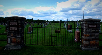
Here you will find an alphabetical list of cemeteries in the Township.
View the Township's Community and Culture Map for additional information.
|
Adamsville Cemetery |
|
Location: Lot 20 Concession 2, Bathurst, near Glen Tay Details: Adamsville is located at the bridge crossing the Tay River. There was once a Wesleyan Methodist Church and cemetery located on this site. There is nothing left to indicate either church or cemetery at the present. There are no markers, but it is believed that there were several burials in this cemetery from 1866 to 1887.On June 27, 1866, William Morris Adams sold part of lot 20 on the 2nd concession of Bathurst to the trustees of the Adamsville Wesleyan Methodist Church for the price of $250. There were three men listed as the cemetery trustees. Their names were James Hargraves, Ralph Dodds and William Robinson. The cemetery was located on the east side of the road and on the south side of the hill overlooking the Tay River. On top of the hill there is a house that is located around 1000 yards away from the site of the church and cemetery. Although the cemetery was situated close to the road, it was hidden behind large lilac trees. Unfortunately, by around 1947-1950 the church foundation and cemetery had almost completely disappeared. At that time, some building stones, and a few illegible and broken headstones remained. There was one stone with the inscription of "Ma--ion", most likely being the name "Manion" as there was a Manion post office near the area. |
|
Bolingbroke Cemetery |
|
Location: 116 Bolingbroke Station Road, Lot 6, Concession 3, South Sherbrooke Details: On September 18th , 1862 a deed was Contact: Darla Kilpatrick, 613-273-5441 |
|
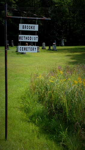
Brooke Methodist Cemetery |
|
Details: On October 3rd, 1866, Donald McKerracher and his wife Sara (nee White) sold part of lot 6 on the 5th concession of Bathurst to Isaac Hamilton, Thomas Kirkham, William Morrow, Thomas Milligan, George Buchanan, and William Buchanan for 5 shillings. These men were the trustees of the Wesleyan Methodist Church. A small frame church stood on the grounds for many years, however it no longer exists. Burials in the cemetery may date back as far as 1879. The Trustees of the Whites Neighbourhood Congregation have owned the land since 1867. The cemetery is still active today and is cared for by the Brooke Methodist Cemetery Board. Contact: Wayne Kirkham, President or Heather Kirkham, Treasurer |
|
Campbell Private Burying Site |
| Location: Lot 13, Concession 11, West of Fallbrook |
|
Drough (Drew) Burial Site |
|
Location: Lot 12, Concession 11, West of Fallbrook Details: A single stone, across the road from the old Drough (Drew) farm, is visible from the road. No names are known. |
|
Erwin Private Burying Site |
|
Location: Lot 14, Concession 11, Bathurst, west of Fallbrook Details: There is a single stone which says: "In Memory of Frances Erwin, wife of James Erwin, who died March 20th, 1860, aged 36 years." |
|
Fagan Lake Cemetery |
|
Location: Lot 19, Concession 9, South Sherbrooke Details: The cemetery was created around 1863 by the St. John in the Wilderness Anglican Church. The village of Rokeby existed at that time in the same location. A church was built on the site, but was taken down in the early 1900's. The last burial in this site was in 1945. Most of the people buried here were from the 11 th line of Bathurst with the rest being from the vicinity of Rokeby village. There were 2 Belgian construction workers killed in a railway accident who were also buried here. The cemetery was abandoned to the Township of South Sherbrooke before the amalgamation into Tay Valley Township. Contact: Tay Valley Township. |
|
Holliday Cemetery |
|
Location: 2345 Scotch Line, Lot 1, Concession 10, North Burgess Details: The site is situated approximately 120 yards from the county concession road, in a field that was once owned by R. G. Armour. The graves are in an area that is 15 feet square, surrounded by a stone wall. Contact: Tay Valley Township. |
|
Johnston Private Burial Site |
|
Location: Lot 15, Concession 11, Bathurst, west of Playfairville
|
|
Maberly United Church Cemetery (Laidley's Cemetery) |
|
Alternate Name: Laidley's Cemetery Location: Lot 14, Concession 10, Maberly, South Sherbrooke
|
|
McVeigh Cemetery |
|
Location: 774 McVeigh Road, Lot 12, Concession 8, Bennett Lake, Bathurst Details: The McVeigh Cemetery is located on part lot 12 on the 8th Contact: Tay Valley Township. |
|
Olde Private Burying Site |
|
Location: Lot 20, Concession 1, Glen Tay Road, Bathurst Details: The Olde burying grounds are located on the west side of the Glen Tay Road. The headstone is located fairly close to the Glen Tay Road, being on the right side just past Grant's Creek Bridge. The stone is surrounded by a wrought iron fence and is surrounded by trees on three of the four sides (the side facing the road is open). Keep an eye out for the spot, as it is very easy to miss when driving by. The entire graveyard has only one stone and is named after the Olde family which is buried there. |
|
Pinehurst Cemetery (Playfairville Cemetery) |
|
Location: 220 Iron Mine Road Details: Since early records of the Pinehurst Cemetery were lost in a fire, it is hard to tell exactly when it was first established. It is believed that the cemetery located on part lot 21 of the 12th concession of Bathurst first started in the 1880's. On August 10, 1928, four and a half acres were sold to the township for $125 for the purposes of a cemetery by Mrs. Forgie. During the cemetery's later years, Mr. James Playfair looked after the cemetery and some burials may date back to 1879. The Pinehurst Cemetery Board, on behalf of the Municipality, ensures that all operations and proceedings of the Pinehurst Cemetery are in accordance with Municipal By-Laws and the Funeral, Burial and Cremations Services Act and its regulations, as amended. Contact: Tay Valley Township |
|
Scotch Line Cemetery |
|
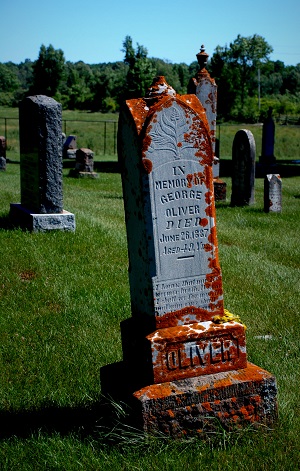
Location: 513 Scotch Line, Lot 12, Concession 10, Upper Scotch Line, North Burgess Details: In 1886, a half-acre of land on the Upper Scotch Line passed hands from Gilbert Wilson and his wife Marian, to a group of men wishing to have a community cemetery. The cemetery trustees were John Wilson, Robert Allan and Robert Hendry. They purchased the half-acre for $75. Although the land was not officially a cemetery until 1886, around ten people had been buried there previous to the purchase. In the same year as its purchase, the Scotch Line Cemetery had its first official burial. The man's name was Mr. George Oliver, a local mill owner, who died at the age of 49 on June 26, 1886. A fence was put up around the cemetery in 1887 and the cost of $40, as well as the purchase price of the land, was paid for by a group of 24 men in the area.A piece of land 10 feet in size was added to the west side of the cemetery in 1920. Also added was a strip of land 40 feet wide fronting the Upper Scotch Line and 210 feet to the rear of the cemetery. The strip was purchased in 1941 from the Scotch Line School, which shared the same lot as the cemetery. In the same year, the land between the west side of the cemetery and Allan's Side Road was purchased for $100 from Gilbert Wilson. The project of planting 200 pine seedlings was completed in May of 1942, with the trees being placed along the fence separating the cemetery from the school, as well as the fence by Allan's Side Road. After its closure in 1968, the remaining school property was purchased for $1000 on July 12 th . This purchase would mark the final expansion of the cemetery. The Scotch Line School is still situated on the cemetery lot and is a beautiful addition to the land. Contact: Allan Menzies, Registrar, 613- 264-2697 |
|
Scott Family Cemetery |
|
Location: Lot 15, Concession 12, Bathurst Details: In the early 1800's, four ancestors of the Scott family were buried on this farmland. Many years later, Ivan Scott decided it would be nice to put up a plaque and a fence around the grave. The site is no longer accessible and is under the management of Tay Valley Township as of 2005. Contact: Tay Valley Township. |
|
St. Andrew's Anglican Cemetery |
|
Details: Once a regular burial ground, the last entry in the St. Andrew's Church Service Book ends in December of 1957. The Church was declared disused and the congregation dispersed by 1961. Today, there are no grave stones or evidence above ground of the grave site. The cemetery was abandoned to the Township of South Sherbrooke before the amalgamation into Tay Valley Township. Information on the cemetery can be found at the Lanark County Archives. Contact: Tay Valley Township. |
|
St. Bridget's R.C. Cemetery |
|
Location: 971 Stanley Road, Lot 15 and 16, Concession 8, Stanleyville, North Burgess Details: Henry and Catherine Cooper sold 2 acres on part lot 16 of the 8th concession of North Burgess to the Kingston Diocese of the Roman Catholic Church. The land was purchased at a price of $125. The transaction was registered at the Lanark County Registry Office in Perth on September 3, 1875. Although it was registered at this time, it is most likely that the transaction took place before this. Reverend Fr. Chisholm and Mr. George Consitt are recorded as being the witnesses. Information on St. Bridget's Cemetery can be found at the Algonquin College Learning Resource Centre in Perth. Contact: St. Bridget's Parish, Stanleyville |
|
St. John the Baptist Cemetery |
|
Details: On November 23, 1863 one half acre of land was deeded to the Ontario Diocese of the Anglican Church for the purpose of a church and cemetery by Robert and Johanna Boles for 5 shillings. The church that once existed here was St. John the Baptist Anglican Church. The church existed until the 1920's when it was dismantled and the lumber was used to construct a residence. There are 30 recorded burials in the cemetery; however, there could be many others that were unrecorded. The last burial in the cemetery was Mr. James Geary in April of 1945. Contact: Anglican Diocese of Ontario |
|
St. Stephen's Anglican Cemetery |
|
Location: Lot 7, Concession 6, Brooke Valley, Bathurst Details: The deed for St. Stephen's Cemetery, registered on March 23rd,1866, states that Richard and Mary Ann White sold part lot 7 on the 6th concession of Bathurst to the Anglican Diocese for $1. The cemetery was once known as "White's Cemetery", and currently, people of any religion are able to purchase plots there. There are different sections of the cemetery, with the old section being across from St. Stephen's Church, and the new part being on the other side of the laneway. Some burials may date back as far as 1840. Information on the cemetery can be found at the Lanark County Archives. Contact: Paul Warwick, 613-267-7615 or paul.g.warwick@gmail.com |


 Location: 20209 Highway 7, Perth, Ontario
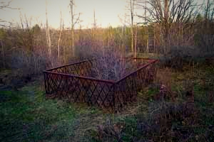 Details: This burial site is believed to be Edward Johnston's private burial plot. Edward Johnston and his family arrived from Ireland on the ship "Atlantic" June 22, 1819. They located on January 23 rd , 1821 in the Township of Bathurst. Apparently, Edward Johnston died in 1853. On this site there are 2 men, 1 woman and a child buried.
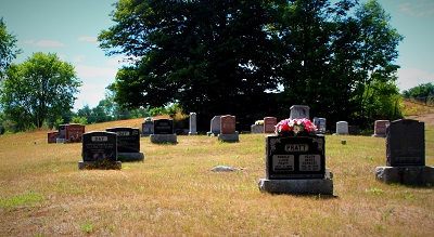 Details: On May 19, 1861, Charles and Anna Judge sold the west half of lot 13 located on concession 10 South Sherbrooke to the Trustees of the Buchanan congregation of Wesleyan Methodists. The trustees were William Robinson, Thomas Moss, John Buchanan, Moses Chambers, Jonathan Thomlinson and Isaac Hamilton. On July 21, 1863, John and Mary Buchanan sold 22,624 square feet to Thomas Moore, John Hannah, George Hughes, William Morrow, William Buchanan, William Armstrong and the trustees of the church for $5. The cemetery has been maintained by the United Church and the Maberly community. Victor Buchanan supervised the cemetery and after his passing, his son James took over. Some burials may date back to as early as 1855.
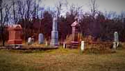 concession of Bathurst, which is also the location of the first school, the SS #11 Bathurst, which dates back to 1820. The school, which was once an Anglican meeting place moved further south around 1879, and the cemetery continued its operation there. The land for the cemetery was originally owned by Mr. Thomas Cooke. The McVeigh cemetery is recognized as being closed and is cared for by the township. Some burials may date back as early as 1850, and there are many burials in the cemetery without a headstone.
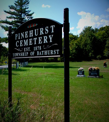 Alternate Name: Playfairville Cemetery
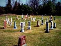 Location:
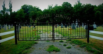
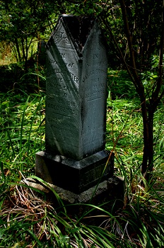 Location: Lot 18 Concession 9, Rokeby, South Sherbrooke.